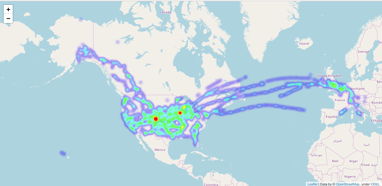
Shortly after the turn of the decade in January, I was perusing Reddit’s /r/dataisbeautiful and found someone who had built a location heatmap using OpenStreetMap, his Google location history, and some python to tie it all together. Given I’ve been carrying an Android phone and letting Google spy on me since early 2010, it seemed like a great way to end off the decade.
My maps for 2010-2020 are at the end of the post. For those wanting to do this for themselves, here’s the easy to follow instructions.
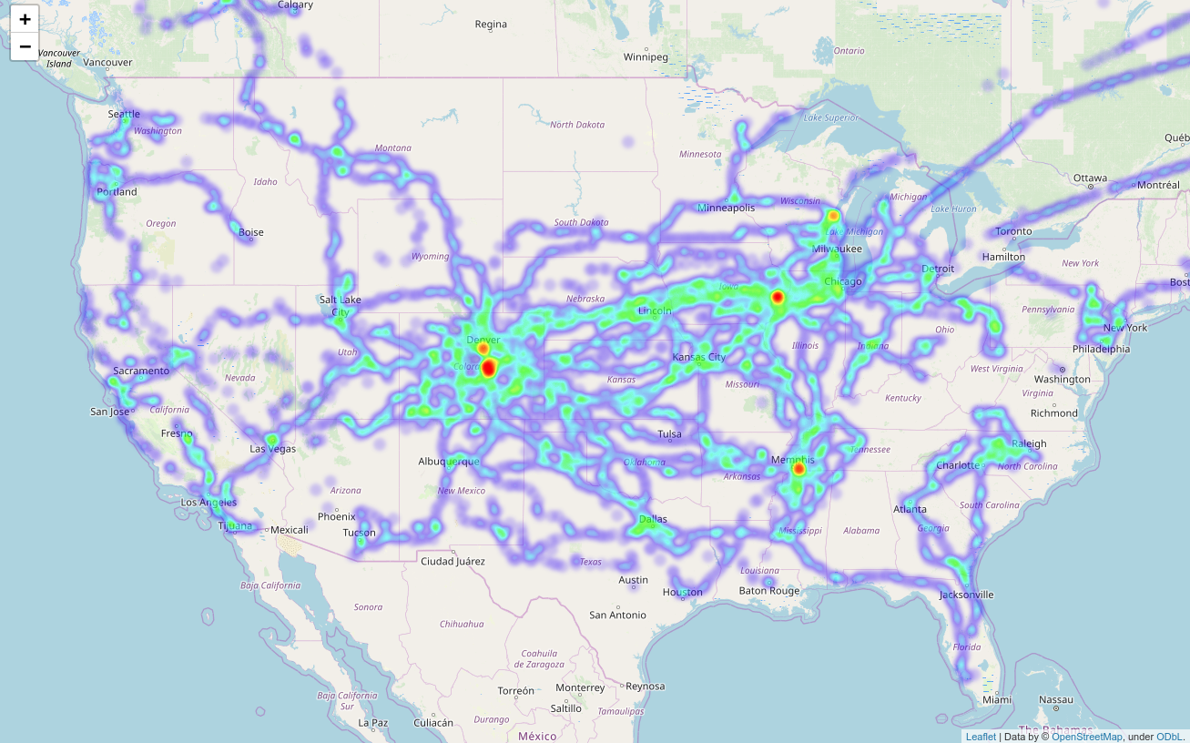
So, without further ado, this is where I’ve apparently been in the last decade. It’s no wonder I’ve put 400k+ miles on cars in the last decade, not to mention the airline and rail miles. It does provide for some interesting learning, however:
- Apparently Google at some point switched to storing my location history in flight, as none of my flights to Hong Kong and Singapore show up (2010-2011), but some of flights to Europe from the 2016-2017 timeframe do.
- I have not been to North Dakota in the last decade. Yeah, not actually shocking.
- My highest dwell times are home (Colorado), Denver, home (Iowa), Memphis (center of the corporate world for me), and Green Bay.
- I’ve apparently conspicuously missed I-15 between Boise and Salt Lake for some reason. Makes sense, I can’t remember driving that stretch since 2006-2007ish.
- Apparently I’m somehow averse to crossing the Appalachians by road this past decade. I’ve got clusters on both sides, but nothing up and over except a flight.
And yes, while I have the full resolution thing, I’m not providing it to any of you…