I’m a sucker for abandoned facilities and wrecks – I love old junk buried under piles of dirt and rock – especially when it’s D&RGW-related. So, upon seeing a message from Matt Hutson on the D&RGW list in early January 2001 concerning some bits of GP9 sticking out of the ground, I was hooked. A few days later, after taking the afternoon off work, I ventured down to Maysville to look for the parts and get a few photos.
First, a bit of history about the units and the area. The only two first generation diesels that have been wrecked on the Monarch Branch were GP9s 5942 & 5943, both in the same incident on 16-Sep-1969. Both units were rebuilt afterwards by EMD and pressed back into service. As for the route, the line was originally part of the narrow gauge network, eventually became standard gauge, and was abandoned in 1982 when Colorado Fuel & Iron no longer had a need for its product. The tracks were ripped up, and at some point after that, parts of the roadbed were converted into a trail (since it does pass through a National Forest, this seems a logical use). Photo #1 gives you an idea what the place looks like, looking downgrade about a mile above the wreck site.
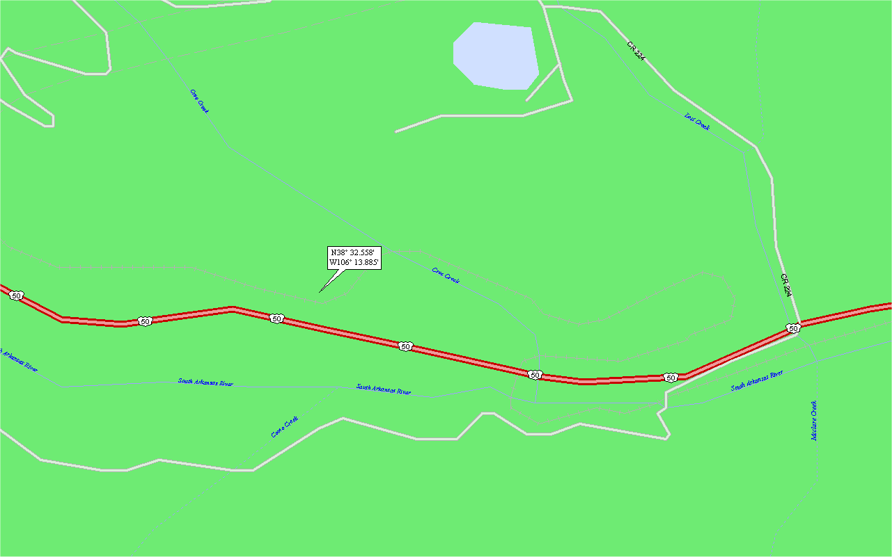
The site of the wreck itself is not hard to locate – it’s a very short but steep walk from US Route 50. I actually didn’t bring my GPS along, and as such wound up walking back down the grade from nearly 2 miles up the line. The incident occurred in a small cut just west of the Cree Creek bridge, where the line starts to loop around to drop a good deal of altitude in a very short distance. One has two options for getting to the location – walk upgrade from the US 50 crossing, or start significantly up the hill and walk back down along the grade. Personally, I’d have to recommend starting upgrade and walking back – it’s an interesting walk, and it good weather gives you a real appreciation for crews that had to control heavy trains on this line. Photo #2 is actually not a photo – it’s a screen capture of the map you’ll need to find the place. For reference, the GPS coordinates should be 38.5426N 106.2314W.
Working east (downgrade) along the line, the first thing you’ll see is a handrail sticking out of the ballast (Photo 3-4). This is attached to a very heavy piece of the pilot that looks to have been torched off. If you look further down in the photo, you’ll see US Route 50, far below my vantage point on the hillside. This gives you some idea of how far you’ll have to climb if you choose the “walk upgrade to the wreck from the US 50 crossing” approach.
Looking a little further beyond the chunk of pilot, visitors will see an old GP7/9 “chickenwire” style radiator grille, fairly twisted and mangled. (Photo 5). This is actually quite a ways (30-40ft) off the right-of-way. These are the only two significant pieces I found on the west side of the cut. Turning our attention further east on the line, photo 6 gives you some idea what the cut looks like from the west end.
Further east in the cut are more parts and pieces, many identifiable as locomotive components. The most easily identified piece is from the front electrical box below the cab. It’s a single plate door, missing its latch. (Photo 7) Looking around a bit further, there are actually quite a few unidentifiable chunks of metal buried in the hillside. One that stands out is part of a locomotive door from the long hood, evidenced by the smashed louvers that are visible above ground. (Photo 8).
After initially posting photos when I got home, Jim Eager of Toronto was kind enough to offer his thoughts on all of the components. His opinion was most valuable on this last, and largest piece of metal. This chunk sits on top of the northern side of the cut on the east end, and to me wasn’t readily identifiable as a piece of GP9. However, to quote Jim, “This looks like a chunk off of the bottom right corner of the pilot, looking at the bottom of the hose box and step. We’re looking at the back of the pilot here.” That’s a much better idea of where it came from than I had, even up close, touching and looking it over.
Unfortunately, due to the season, I had very limited light by the time I found the wreck site. By the time I had walked the two miles back to my truck, the light was gone entirely. Some day, I’ll probably go back – not so much because 32-year-old rusting scrap interests me, but the branch itself would be an interesting walk when it gets warmer outside.


This work is copyright 2026 by Nathan D. Holmes, but all text and images are licensed and reusable under a Creative Commons Attribution-NonCommercial-ShareAlike license. Basically you’re welcome to use any of this as long as it’s not for commercial purposes, you credit me as the source, and you share any derivative works under the same license. I’d encourage others to consider similar licenses for their works.